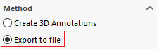
Export to file
This mode allows you to export, for example, the XYZ coordinates of selected points or entities. Markers are added to both the export file and the 3D geometry in the form of marker annotations.
As with the creation of 3D annotations, the first step is to select the coordinates to be extracted (see: Select the coordinates to be extracted)
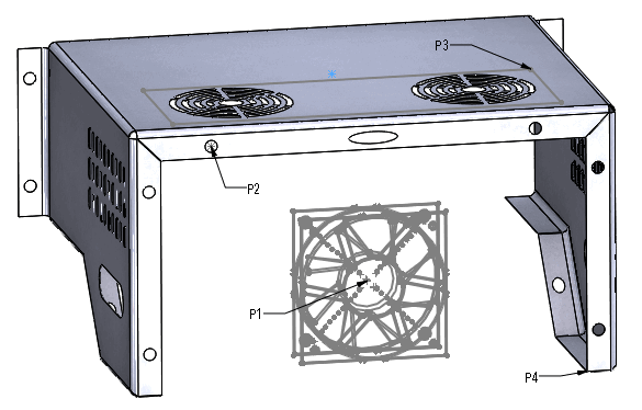
For example, we're going to use the point or vertex selection mode, and we're going to activate all the selection filters.
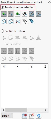
Simply make selections of points or arcs of circles to create a marker annotation in the graphics area.
A table is then created in the '' zone.Select the coordinates to be extracted'' :
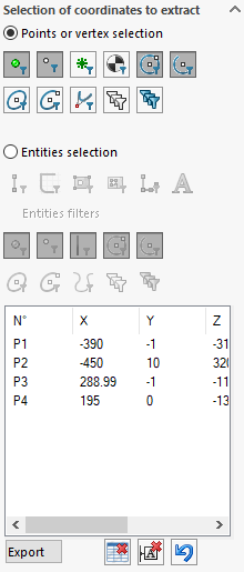
This data can then be exported as an Excel table.
Click on this button  allows you to choose the destination location for the Excel file.